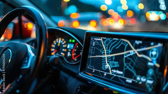
How Does My Car Navigation System Work Step by Step
Your car navigation system uses GPS satellites, a built-in receiver, and smart software to guide you from point A to point B. It calculates the best route, gives you turn-by-turn directions, and updates you on traffic in real time. Understanding how this technology works helps you use it better and avoid common mistakes.
Have you ever wondered how your car navigation system knows exactly where you are and which way to turn? It feels like magic. But the truth is, it is a fascinating mix of space technology, smart software, and real-time data.
Whether you drive a new sedan or an older SUV, your car navigation system works hard every time you type in a destination. It pulls in signals from space, compares them against detailed map databases, and talks you through each turn. And the best part? You do not need to be a tech expert to understand how it all comes together.
In this article, we will walk you through how does my car navigation system work step by step. We will break down every part of the process in plain, simple language. By the end, you will understand your system better than most people do. Let us get into it.
Key Takeaways
- GPS satellites send signals to your car: Your navigation system picks up these signals to pinpoint your exact location.
- Multiple components work together: The GPS antenna, receiver, processor, and map database all play a role.
- Route planning is smart: The system considers distance, traffic, road type, and speed limits to find the best path.
- Live traffic updates save time: Real-time data helps your system reroute you around congestion.
- Voice guidance and visual cues make it easy: You stay focused on the road while the system talks you through each turn.
- Regular updates keep it accurate: Outdated map data leads to wrong directions and frustration.
📑 Table of Contents
What Is a Car Navigation System?
A car navigation system is a built-in or mounted device that helps you find your way from one place to another. It uses GPS technology (Global Positioning System) to track your location. Then it overlays that location on a digital map to guide your drive.
Modern navigation systems do much more than just show a map. They offer turn-by-turn directions, live traffic updates, speed limit alerts, and even suggestions for nearby gas stations or restaurants. Some systems work offline. Others need an internet connection to pull in real-time data.
The basic idea has not changed much over the years. A GPS receiver inside your car talks to satellites orbiting Earth. Those satellites send back signals. Your system uses those signals to figure out where you are. From there, it calculates the best route to your destination.
A Brief History of Car Navigation
Car navigation was not always this advanced. In the early days, drivers relied on paper maps and road signs. Then came the first GPS devices in the 1980s. These were bulky and expensive. By the 2000s, built-in car navigation became common in mid-range vehicles. Today, most new cars come with navigation as standard or optional. And smartphones have made navigation even more accessible.
How GPS Signals Reach Your Car
The heart of any GPS navigation system is the satellite network. Here is how it works in simple terms.
The United States operates a network of about 30 GPS satellites. They circle the Earth at an altitude of around 12,000 miles. Each satellite constantly sends out a signal that includes its location and the exact time the signal was sent.
Your car’s GPS antenna picks up these signals. The receiver inside the system then calculates how long each signal took to arrive. Since the signals travel at the speed of light, the system can figure out the exact distance between your car and each satellite.
To get an accurate location, your system needs signals from at least four satellites. Three satellites give you a 2D position (latitude and longitude). Four or more give you a 3D position (latitude, longitude, and altitude). This process is called trilateration, and it happens in a fraction of a second.
Why Signal Strength Matters
GPS signals are weak by the time they reach Earth. Tall buildings, dense forests, and steep mountains can block or weaken them. This is why your navigation might lose accuracy in tunnels or urban canyons. Some newer systems use dead reckoning to fill in the gaps. Dead reckoning uses sensors like gyroscopes and wheel-speed sensors to estimate your position when GPS signals are lost briefly.
How Your GPS Receiver Works
The GPS chipset inside your car is a tiny but powerful processor. It does the math needed to decode satellite signals and calculate your position. Modern chipsets are incredibly fast and accurate. They can track dozens of satellites at once and refine your location to within a few meters.
Once your system knows where you are, it compares that position to the digital map stored in its memory. This is called map matching. It ensures the blue dot on your screen lines up with the actual road you are driving on.
The Components Inside Your Navigation System
Your car’s navigation system is made up of several key parts. Each one plays a specific role in getting you from point A to point B. Let us look at them one by one.
1. The GPS Antenna
The GPS antenna is usually mounted on the roof or dashboard of your car. Its job is to catch signals from the GPS satellites. A good antenna picks up weak signals clearly. This is why the placement matters. A poorly placed antenna can lead to inaccurate location tracking.
2. The GPS Receiver and Processor
The receiver decodes the signals the antenna catches. The processor then runs complex calculations to determine your exact position. Think of the antenna as the ears and the processor as the brain. Together, they make GPS navigation possible.
3. The Map Database
Your system stores a digital map database in its memory. This database contains road networks, speed limits, points of interest, and more. Companies like HERE, TomTom, and NavInfo build these databases. They update them regularly to reflect new roads, changed speed limits, and construction zones.
4. The Display Screen
The screen shows your current location, the route, and upcoming turns. Modern displays are bright, touch-sensitive, and easy to read. Some systems project navigation info onto the windshield using a head-up display. This lets you keep your eyes on the road.
5. The Voice Module
The voice module gives you spoken directions. It tells you when to turn, when to change lanes, and when you are approaching your destination. Good voice guidance is essential for safe driving because it lets you keep your eyes on the road.
How Routes Are Calculated Step by Step
Now that you know the hardware, let us talk about the software. When you type in a destination, your system goes through a specific process to plan your route. Here is a step-by-step look at how route planning works.
Step 1: You Enter a Destination
You type in an address, select a point of interest, or say a destination aloud using voice commands. The system converts your input into GPS coordinates — a set of numbers that pinpoints a location on Earth.
Step 2: The System Checks the Map Database
Your navigation system looks up the destination in its map database. It finds the road segment closest to the coordinates you entered. If the address is not found, it may try to match it to the nearest known location.
Step 3: The System Determines Your Starting Point
Using the GPS signals we talked about earlier, the system figures out where you currently are. It places you on the nearest road in the map database. This is the starting point for your route.
Step 4: The Routing Algorithm Kicks In
This is where the magic happens. The system uses a routing algorithm to find the best path between your starting point and your destination. It considers several factors:
- Distance: The shortest route in miles or kilometers.
- Travel time: How long the route takes based on road types and speed limits.
- Traffic conditions: If the system has live traffic data, it avoids congested roads.
- Road restrictions: One-way streets, no-left-turn zones, and weight limits.
- User preferences: Some systems let you avoid tolls, highways, or ferries.
Step 5: The System Generates Turn-by-Turn Directions
Once the route is set, the system breaks it down into individual maneuvers. It creates turn-by-turn directions with specific instructions like “Turn left in 500 feet” or “Merge onto Highway 101 North.” Each instruction is tied to a specific location on the route.
Step 6: The System Guides You in Real Time
As you drive, the system constantly monitors your position. It compares your actual location to the planned route. If you drift off course, the system recalculates routes automatically and gives you new directions. This is one of the most impressive features of modern navigation.
How Waypoints Fit Into Route Planning
A waypoint is an intermediate stop along your route. You can add multiple waypoints to create a multi-stop journey. For example, you might want to pick up groceries before heading home. Your system will adjust the route to include the stop while still aiming for the most efficient path.
Real-Time Traffic and Live Updates
One of the biggest advantages of modern car navigation systems is their ability to provide live traffic updates. But how does this work?
There are two main ways systems get traffic data. The first is through cellular networks. Your system connects to the internet and pulls in traffic data from services like Google, Waze, or HERE. The second method uses data from other connected vehicles. As cars on the road report their speed and location, the system builds a real-time picture of traffic flow.
When the system detects a slowdown or a blockage ahead, it recalculates your route. It may suggest an alternate road that is faster. This dynamic rerouting can save you significant time, especially during rush hour.
How Traffic Data Is Updated
Traffic data is updated continuously. Some systems refresh every few minutes. Others update in near real-time. The accuracy depends on the data source and the number of connected vehicles in your area. In busy cities, traffic updates are usually very accurate. In rural areas, the data may be less reliable.
Does Your System Need an Internet Connection?
Not always. If your system has a preloaded map database, it can navigate without the internet. However, you will not get live traffic updates, weather alerts, or search results for nearby places without a connection. Some systems use your phone’s hotspot to bridge this gap.
Tips to Get the Most From Your Car Navigation System
Now that you understand how your system works, here are some practical tips to help you use it better.
1. Keep Your Maps Updated
Outdated maps are one of the biggest causes of wrong directions. Road changes happen constantly. New subdivisions, changed street names, and rerouted highways can all confuse an old map database. Check for map updates regularly. Many systems let you download updates through Wi-Fi or a USB connection.
2. Calibrate Your GPS Antenna
If your location dot is jumping around or pointing to the wrong road, your antenna may need recalibration. Park your car in an open area away from tall buildings. Let the system lock onto satellites for a few minutes. This usually fixes minor accuracy issues.
3. Use Voice Commands When Possible
Typing on a screen while driving is distracting. Most modern systems support voice commands. You can say “Navigate to [destination]” and the system will handle the rest. This keeps your hands on the wheel and your eyes on the road.
4. Plan Your Route Before You Drive
Before you start the engine, set your destination. This gives the system time to calculate the best route. It also means you are not fiddling with the screen while driving in traffic.
5. Understand Offline vs. Online Navigation
Offline navigation works without a data connection. It uses stored map data and GPS signals. Online navigation adds live traffic, search results, and points of interest. If you frequently drive in areas with poor cell coverage, offline navigation is your best bet.
6. Clear Your Cache Regularly
Over time, your navigation system can accumulate temporary data that slows it down. Clearing the cache frees up memory and helps the system run smoothly. Check your owner’s manual for instructions on how to do this for your specific model.
Common Mistakes People Make With Car Navigation
Even the best navigation systems can lead you astray if you make these common errors:
- Trusting the system blindly: Always use your own judgment. The system does not know about road closures, accidents, or temporary hazards.
- Ignoring map updates: This is the number one cause of navigation errors.
- Mounting the device poorly: If you use a mounted device, make sure it does not block your view or become a projectile in a sudden stop.
- Not checking the route before you start: A quick glance at the planned route can save you from a wrong turn.
Frequently Asked Questions
How accurate is a car navigation system?
Most modern GPS navigation systems are accurate to within 3 to 5 meters under open sky. Accuracy can drop in tunnels, dense cities, or areas with heavy tree cover. Systems with dead reckoning and GLONASS support tend to maintain better accuracy in challenging environments.
Can I use my car navigation system without an internet connection?
Yes, you can. Built-in systems store map data locally on the device. You do not need the internet for basic navigation. However, you will miss out on live traffic updates, weather alerts, and search results for nearby places without a connection.
How often should I update my car navigation maps?
It is best to update your maps at least once a year. Roads change frequently. New businesses open, street names change, and construction alters routes. Some systems notify you when updates are available. You can also check the manufacturer’s website for the latest versions.
What is the difference between GPS and a navigation app on my phone?
GPS is the technology that determines your location using satellites. A navigation app uses GPS data and combines it with map databases, traffic data, and routing algorithms to guide you. Built-in car systems and phone apps both use GPS, but car systems are often integrated more deeply with your vehicle’s features.
Why does my navigation system sometimes give wrong directions?
Several factors can cause incorrect directions. Outdated map data is the most common culprit. Other reasons include poor GPS signal, incorrect starting location, or the system choosing a route based on outdated traffic patterns. Keeping your maps updated and ensuring good satellite reception helps minimize these issues.
Do I need a premium subscription for live traffic updates?
Some car navigation systems require a paid subscription for live traffic and connected services. Others include these features for free for a limited time. Check with your dealer or the system manufacturer to understand what is included with your vehicle. Many modern systems now include free lifetime traffic updates.
Conclusion
Understanding how does my car navigation system work step by step is easier than most people think. Your system uses GPS satellites, a smart receiver, a detailed map database, and powerful algorithms to guide you every day. From calculating the fastest route to rerouting you around traffic, it works behind the scenes to make your drive smoother and safer.
The key components — the antenna, the processor, the map database, the display, and the voice module — all work together seamlessly. And with regular map updates and a few simple best practices, you can get the most out of your car navigation system for years to come.
So the next time you type in a destination and hear “Turn left in 500 feet,” you will know exactly what is happening behind the scenes. Your car is talking to satellites in space, crunching millions of data points, and giving you the best path forward. That is pretty amazing.
Take a few minutes today to explore your system’s settings. Update your maps. Try voice commands. And remember, the technology is there to help you — but your good judgment always comes first. Safe travels!